Celia
Mariners' Museum, Uncurated Search Results
Type: Skipjack
Year: 1899
Builder: Greenbury M. Coffin
Location: Claiborne
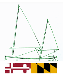
These records are found in the online catalog of The Mariners’ Museum and Park in Newport News, Virginia. Uncurated search results are presented to give researchers and interested readers an idea of whether the museum’s archives contain information about this vessel and whether it may be worthwhile to visit the museum’s catalog search page for further investigation. Uncurated results may be inaccurate or incomplete.
Search mode: Exact Name. Search phrase(s): "Celia". Results returned: 12. Results displayed in this table: 12.
Use these buttons to send uncurated search results to your own app or text document for further research. First, check the box for any row, or click "Select All" then uncheck any rows. Then click "Show Selections". You can then copy your selections from the text box and past them into your app.
| Fetch? | Row ID | Media | Date | Vessel | Place | Related Places | Inscription/Marks | Subject | Notes | Archive Number |
|---|---|---|---|---|---|---|---|---|---|---|
| 1 | No image URL. | Celia F. | P0001.011/01-0553 | |||||||
| 2 | No image URL. | Sandpiper : __the life & letters of Celia Thaxter, and her home on the Isles of Shoals, her family, friends & favorite poems | LB14593 | |||||||
| 3 | No image URL. | Isles of Shoals (Me. and N.H.)–Description and travel.; Isles of Shoals (Me. and N.H.)–History | Among the Isles of Shoals __ __by Celia Thaxter | LB81922 | ||||||
| 4 | No image URL. | Virginia–Population–Statistics | Slave trade–Virginia–Statistics.; Slaves–Virginia–Statistics. | Virginia slave-trade statistics, 1698-1775 __ __edited by Walter Minchinton, Celia King, and Peter Waite | LB96788 | |||||
| 5 | No image URL. | Titanic (Screw schooner : 1912).; Carpathia (Screw schooner : 1903). | Shipwrecks–North Atlantic Ocean–Personal narratives.; Shipwreck survival. | Includes a copy of a letter written on the Titanic and posted in Queensland. | LB107528 | |||||
| 6 | No image URL. | Shenandoah (Cruiser : 1864). | The CSS Shenandoah was detained in Australia on the grounds that shewas a pirate ship. Her captain eventually relied on international law to have her released. | LB56673 | ||||||
| 7 | No image URL. | Great Eastern (Screw and paddle bark : 1858). | Thames Tunnel (London, England). | "First published 1938." "List of books consulted": 263-264. | LB20801 | |||||
| 8 | No image URL. | Fairsea (Motor vessel : 1949).; Canberra (Turbo electric vessel : 1961).; Oriana (Turbo steamship : 1960).; Olympic (Screw schooner : 1911).; Lusitania (Turbo steamship : 1907)–In art.; Titanic (Screw schooner : 1912)–In art.; Queen Mary (Turbo steamship : 1936).; Mauretania (Turbo steamship : 1939).; Nomadic (Screw sloop : 1911).; Traffic (Screw sloop : 1891).; Nomadic (Screw sloop : 1911). | Marine art, American. | The life and art of Ken Marschall. | LB108218 | |||||
| 9 | 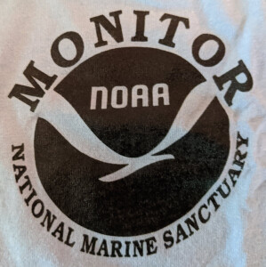 | SHORT DESCRIPTION: Light blue t-shirt with NOAA's Monitor National Marine Sanctuary logo on the front and on the back a line drawing of a diver measuring the USS Monitor's turret upside down and under the armor belt on the floor of the ocean. An underwater vehicle similar to the Johnson Sea Link sits at the right. The text 'MONITOR MEETS NOAA SHIP FERREL' and the date '1994' surround the image. The shirt has a tag in the collar that indicates it was manufactured by Fruit of the Loom, with BEST trademark, size large, made of 50% cotton and 50% polyester, and made in the United States. NOTES: It's not clear which expedition this shirt is related to. The NOAA logs for the voyages of Ferrel show that the ship was off the North Carolina and South Carolina coasts from November 17 to December 7, 1994, possibly as part of the Sea Grant program. According to the book Ironclad Revolution: The History, Discovery and Recovery of the USS Monitor by Anna Holloway there were several expeditions to the wreck site in 1994 but none seem to include the Ferrel: June 11- 13, 1994 Expedition Team: NOAA Expedition Goals and Achievements: A 6,000-pound anchor was placed approximately 200 feet southwest of the wreck and a sub-surface buoy attached to the anchor 50 feet below the surface. August 16, 1994 Expedition Team: NOAA, Harbor Branch, and the US Navy Expedition Goals and Achievements: An annual site assessment was carried out. NOAA and navy personnel examined the wreck to evaluate recovery options. Using the R/V Sea Diver and the submersible Celia, a controlled video study of the wreck was carried out. Only one submersible dive was completed due to adverse weather conditions. September 26 - 28, 1994 Expedition Team: US Navy Reconnaissance Expedition Expedition Goals and Achievements: A planned inspection and survey in preparation for 1995 mission to recover the Monitor's propeller was severely affected by strong currents at the site. NOTES: This collection of t-shirts, polo shirts and hats was compiled by Dr. John D. Broadwater over the course of his work with the various companies and institutions that helped explore and eventually recover parts of the USS Monitor wreck from the floor of the ocean off Nags Head, North Carolina. VESSEL INFORMATION- VESSEL NAME: FERREL (S 492) VESSEL TYPE: Hydrographic Survey Ship BUILDER: ZIGLER SHIPYARDS BUILDER LOCATION: JENNINGS, LOUISIANA BUILD DATE: 1967-1968 VESSEL HISTORY: Originally built for the United States Coast and Geodetic Survey which operated the vessel between 1968-1970. She became part of the NOAA fleet on October 3, 1970. | CL31309 | |||||||
| 10 |  | SHORT DESCRIPTION: Black and white aquatint engraving titled "View of Tetuan, on the Coast of Morocco." Engraved by Wells and published in the July to December issue of The Naval Chronicle, page 142. The artist is identified only as "P.S.O." The image shows the United States Navy frigate Philadelphia under topsails at the center, sailing towards Tetuan. The town can be seen in the background at the left, situated among mountains. Two ships, HMS Caesar and HMS Superb, according to the article in The Naval Chronicle, are anchored in front of the town. A small lateen rigged vessel is in the background at the right. Looking at the history, USS Philadelphia could have visited Tetuan any time between August 24 and September 15, 1803. NOTES: USS Philadelphia was in ordinary from August 1802 to May 1803 when she was recommissioned. She was commanded by Captain William Bainbridge and sailed for the Mediterranean on July 28, 1803 and arrived in Gibraltar on August 24th. Two days later the ship recaptured the American brig Celia of Boston from the Morocco ship-of-war Mirboka and brought the both into Gibraltar. In September Commodore Edward Preble sent USS Philadelphia to blockade Tripoli harbor. On October 31, Philadelphia ran aground the Kaliusa Reef and was unable to be refloated and was boarded and taken possession of by the Tripolitans who were able to refloat the ship several days later. NOTES: Text from The Naval Chronicle, Volume X, from July to December 1803, pages 141-143: DESCRIPTION OF PLATE CXXXII. This view represents the town of Tetuan with the country adjacent, on the coast of Morocco, near which are Sir James Saumarez's ship, the Caesar, and the Superb, at anchor. In the foreground is introduced the American frigate Philadelphia, going into the bay to water, and on the right is a small Moorish boat, one of those usually employed in carrying provisions to Gibraltar. Tetuan is just within the Straits of Gibraltar, in the Mediterranean, and is seen immediately on doubling the point of Ceuta on the African shore. It is situated upon a hill, at the distance of a mile from the sea, and ships may go on S. from Ceuta till the E. end of the town lies even with a round hill that stands upon the high land. There is a black old tower in the middle of Tetuan, and behind the town three little hills; and when these hills are brought on with the said tower, ships may come to an anchor, but at such a distance from the shore as that the first hill to the S. of Ceuta may be seen towards Cape Porcus, where there is good riding and clean ground in sixteen fathoms. Care must be taken as to the place of anchorage here, which is not more than two cables length in circumference; and if ships miss it, they will be in danger of losing their anchors. Tetuan is not a port, nor has it a harbour. Cape Tetuan, which is about nine or ten leagues from Ceuta, is two or three leagues from the town of its name. The necessity of not mistaking one cape for the other has been noted under Cape Porcus. | CL18861 | |||||||
| 11 | No image URL. | California–History, Naval. | Shipwrecks–California; Sea monsters–California | Shipwrecks & sea monsters of California's central coast __ __by Randall A. Reinstedt ; illustrated by Antone A. Hrusa | LB101504 | |||||
| 12 | 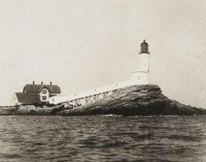 | on verso: built 1821, rebuilt 1859, 58 ft. high. | View from the water of the lighthouse, other structures and covered walkway between them. The Isles of Shoals are a small group of nine islands six miles off the Atlantic coast straddling the border between Maine and New Hampshire. The islands were divided up in 1629 between Captain John Mason, who owned New Hampshire, and Sir Ferdinando Gorges, who owned the Province of Maine. Maine ended up with five of the islands and New Hampshire the other four. The Isles of Shoals Lighthouse sits atop White Island, the most southerly of the islets. Although the Isles of Shoals are mostly barren and sparsely populated today, they have a lively history. They were originally named the Smith Islands (or Smith’s Isles in some accounts), after the famous Captain John Smith who helped settle the Jamestown Colony in Virginia in 1607. Smith had spent a number of years exploring the coast off Maine, mapping the coastline and naming many of the islands. However, these islands were the only ones he decided to put his own name on – apparently their beauty earned them a special place in Smith’s heart. Early fishermen changed the name to Shoal of Isles, reportedly because the islands resembled a shoal of fish. Later, the name became Isles of Shoals. In 1623, a fishing settlement was started on the islands, and within five years there were enough people living there to support two taverns. Maine’s first church followed a few years later in 1640. Some of the resident fishermen thought the islands should be an all-male preserve. In 1647 Richard Cutt, a settler on Hog Island (now more elegantly named Appledore Island), filed an official complaint: “John Reynolds has brought his wife hither with the intention that she live and abide here, contrary to an act of court which says that no woman shall live upon the Isles of Shoals…he has also brought upon Hog Island a great stock of goats and swine which spoil the spring water…our petitioners therefore pray that the Act of Court be put in execution for the removal of women inhabiting here.” The courts ordered that the goats and swine be removed, but allowed the women to stay. In 1702, the captain of a visiting French ship estimated the population of the islands to be around 500 people. During the Revolutionary War, the residents of the islands were thought to be mostly loyal to England and were forced to leave. After the war, the islands former inhabitants had settled down elsewhere and did not return to reclaim their homes. The first lighthouse and accompanying dwelling on the Isles of Shoals were built of rubble stone in 1822. The tower stood 40 feet high, and the copper-domed birdcage lantern an additional ten feet or so above that. White Island is mostly barren rock with a very steep and rugged southern face rising 80 feet above the water. The lighthouse is located on this side of the island at the highest point above the water. Even at that height, the storms at this location are so fierce that the covered walkway connecting the tower to the keeper’s quarters has been completely washed away three times. One of the more colorful keepers at Isle of Shoals Light was one Thomas Laighton. After losing the election for governor of New Hampshire in 1839, Laighton applied to be keeper at the lighthouse, and was appointed in 1843 at a salary of $600 a year. Laighton had previously purchased four other islands in the group (Appledore, Smuttynose, Malaga, and Cedar Islands). Laighton’s wife, two daughters, and hired hand did most of the actual lighthouse keeping, while Laighton attended to business on the mainland. In 1841, Winslow Lewis had outfitted the White Island Lighthouse with an updated lantern and lighting apparatus. The new optic consisted of a triangular frame that supported five lamps and reflectors on each face. One of the faces was covered by red glass to produce a white-red-white flashing characteristic as the frame made one revolution every three minutes and fifteen seconds. Keeper Laighton’s daughter would later become the well-known poet Celia Thaxter, who drew upon her early life at the lighthouse for some of her most inspirational work. The tower’s light was thus described by Celia in the poem “The Wreck of the Pocahontas”: I lit the lamps in the lighthouse tower, For the sun dropped down and the day was dead. They shone like a glorious clustered flower, - Ten golden and five red. After constructing a hotel on Appledore, Laighton resigned his lighthouse post in 1849 and moved his family into the hotel. Following Laighton’s death, his sons continued running the hotel until it burned down in 1914. Most of the Laighton family is buried in a family cemetery on Appledore Island, and their graves can still be seen today. Exposed to the full fury of the Atlantic, the original stone lighthouse began deteriorating quickly, and in 1843 it was covered in wood and shingled in an attempt to protect the stone exterior. This measure bought some time, but a replacement brick tower was built in 1855. A second-order Fresnel lens, which produced a flashing red and white light visible for 15 miles, was housed atop the new tower. John Downs was serving as acting keeper at the lighthouse while the head keeper went ashore, when a gale struck one March. Late one night, when the storm had been raging a week, Downs’ friend, who was stranded with him at the lighthouse, joked, “Well, John what would you think if somebody was to knock on the door just now?” John replied, “I should think it was the devil himself, for no human being could land alive on the island tonight with that storm raging.” Shortly thereafter a rap, rap, rap at the door startled the two men. After summoning enough courage to open the door, they found a bleeding and drenched sailor who announced “Brig Ashore, sir! Right near the tower!” The sailor had volunteered to be lowered from the bowsprit of the grounded Russian brig and attempt to reach the lighthouse keeper. Though pummeled by waves that threatened to draw him off the rocky shore, the sailor somehow managed to claw his way to the dwelling. Downs, his friend, and the keeper succeeded in rescuing the entire crew of the brig by serving as an anchor to a line they had tossed to the vessel. The original stone keeper’s dwelling was in such disrepair that the Lighthouse Board’s annual report for 1876 described it as “…so much decayed that it is scarcely habitable.” Two years later, a new wood-framed one and a half story duplex was completed for the keeper and his assistant. The old stone house was remodeled and used for storage. The station was equipped with a fog bell from the beginning, but it had little effect in such a location, since the strong winds on all sides masked the sound. In 1896 a larger bell was tried, but it too was deemed inadequate. An automated fog bell was installed in 1906 before a 1st-class air siren, putting out a three-second blast every 30 seconds, was finally placed on the island. The Coast Guard removed the 1878 duplex in the 1950’s and constructed a modern residence on the site of the original dwelling. Following a three-month-long automation process, Coast Guard personnel were removed from White Island in 1986. A few years later, the tower’s Fresnel lens was removed in favor of a modern beacon. In 1993, White Island and a couple other islands in the group were transferred to the New Hampshire State Parks system. The station had fallen into disrepair by the start of the new millennium, but a group of local students at North Hampton School known as the Lighthouse Kids took on the mission of raising funds to restore the lighthouse. In April of 2003, their efforts were rewarded with a $250,000 Save America’s Treasures Grant. Through their own projects, they raised additional money, and in 2005, the towers was repaired and covered in a fresh stucco coating, and the dwelling received a new roof. References “Isle of Shoals,” Wayne Wheeler, The Keeper’s Log, Fall 2002. Lighthouses of Maine, Bill Caldwell, 1986. Historically Famous Lighthouses, U.S. Coast Guard. | P0001.012/01-#PL014 |
Created 2026 by Don Barker, CBMM volunteer, for the Chesapeake Shipbuilding Project. shipbuilding@sailingworkboats.es